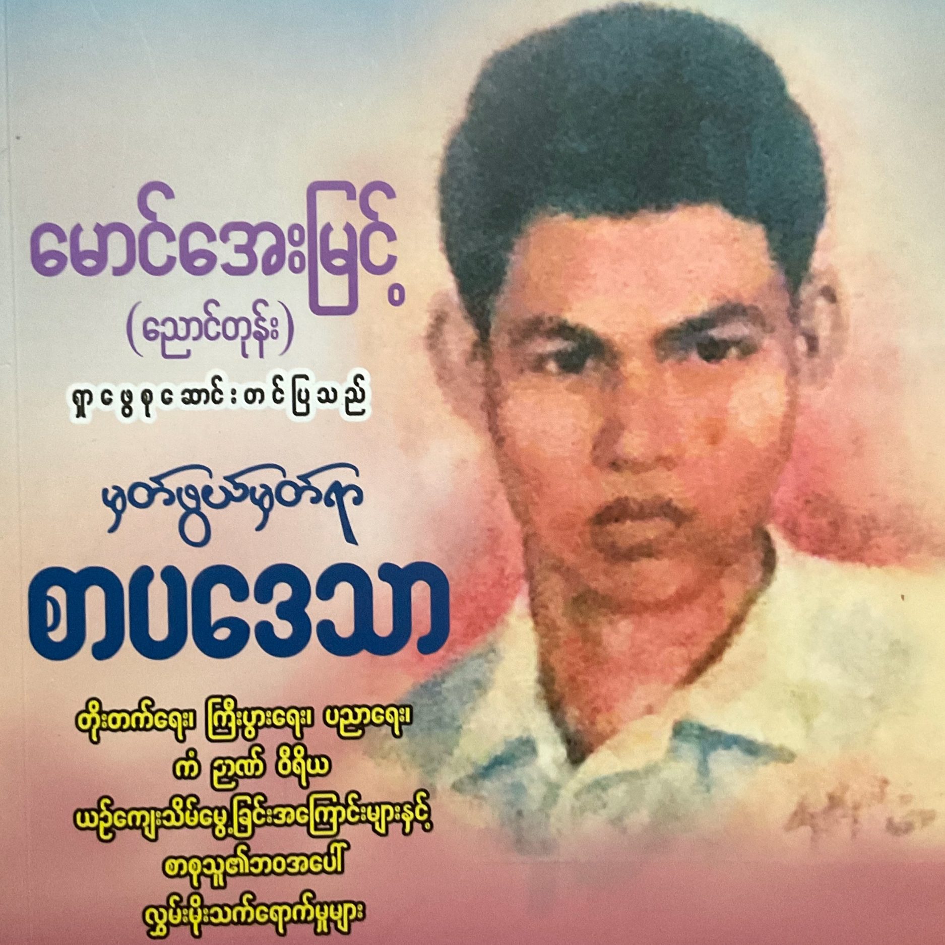

1
ဆရာတော်ကြီးများ
လယ်တီဆရာတော်
vipassana teacher that we know of in this tradition in modern times with such detail. His great innovation was to start spreading the actual practice widely and to householders.”
In this video, Patrick Given-Wilson explores the life of this meditation master and magnificent pariyatti scholar who authored over a hundred expositions on the Dhamma. He was perhaps the most outstanding Buddhist figure of his age. All who have come in contact with the path of Dhamma in recent years owe a great debt of gratitude to this scholarly, saintly monk who was instrumental in reviving the traditional practice of vipassana, making it more available for renunciates and lay people alike.
https://youtu.be/qgCKCY1xx_g?si=0NvWrYjdjv3QUM8H
ဆ၇ာသက်ကြီး
In this video, Patrick Given-Wilson explores the life of Saya Theygyi who became a critical link, between the great monk Ven. Ledi Sayadaw and Sayagyi U Ba Khin, in helping to establish a tradition of vipassana householder teachers.
https://youtu.be/slOMkNlkues?si=QHojPsRvXZbccdeu
…………’
ဝေဘူဆရာတော်တရားများ
Webu Sayadaw was important for two reasons. One was that in his time he became one of the most venerated monks in Burma; he was known as an arahant, a fully-liberated person. And the second reason is that he encouraged Sayagyi U Ba Khin, Goenkaji’s teacher, to start teaching meditation without delay. For a householder to be encouraged by a monk of such standing, gave Sayagyi enormous status, prestige and backing in his work throughout his life.
In this video, Patrick Given-Wilson explores this important relationship between Ven. Webu Sayadaw and Sayagyi U Ba Khin taking us through the significant life events of this inspiring monk who was known for giving all importance to diligent practice over scholastic achievement.
Find this video in Italian here: • Video
https://youtu.be/dmKg66ucVio?si=ovowsooSeCcnPIZ_
…………
ဆ၇ကြီးဦးဘခင်အမှတ်တရ VCD
https://youtu.be/AXXJRbuLt_w?si=zwb6KU9DYmtFZail
…………
2
U Nu speaking about Buddhism
Interview with the Burmese Premier U Nu around 1956 for the American series See It Now, in which he discusses Buddhism and appears to claim to have entered the first path (sotapatti).
https://youtu.be/bGKdUJoah6Y?si=xaaHbN9KHFvHJo7K
3
U Thant -Myanmar’s UN Secretary General of Burma
TIME STAMPS
1:38 Who was U Thant?
3:02 Why does U Thant have a museum?
6:25 A GRAB to U Thant House
11:11 Arriving at U Thant House
15:34 Tragic Ending
21:25 U Thant’s Life & Path to the UN
26:48 The Verdict
28:56 On the Bus Back to Sule Pagoda
32:18 Conclusion
33:02 Post Credits Scene
U Thant House in Yangon celebrates the life of one of Myanmar’s most famous citizens. U Thant was born in a small town in the Irrawaddy Delta and went on to become the world’s top diplomat – the Secretary General of the UN.
U Thant was only the 3rd UN Secretary General and the first non-European to hold the post. He was elected unanimously to the post in 1961 and remained Secretary General until 1971. During his term, he dealt with a series of great challenges and left a profound mark on both the UN and the world at large.
I was suffering a little bit from some earlier long walks around Yangon, so on this occasion, I decided to give my feet a rest and take a GRAB to U Thant House for a relaxing tour and no chance to get distracted along the way.
Cheers,
Douglas (AKA The Cycling Canadian)
MESSAGE FROM THE CYCLING CANADIAN:
Thanks for checking out this video. I am the Cycling Canadian (AKA Douglas), and I’m making videos about my experiences traveling around the world both on and off a touring bike. I travel on a low budget, so I tend to stay in simple guest houses and spend my time exploring the local streets and markets on foot.
UPLOAD SCHEDULE
I upload videos every week – sometimes two or three times a week. I’ll be going to lots of interesting countries in the future, so if you subscribe to my channel, you won’t miss any of these adventures.
WANT TO SUBSCRIBE? THANKS!! JUST CLICK HERE
https://www.youtube.com/c/TheCyc…
https://youtu.be/6HWo1JREvbc?si=oxwew2oJRcN2EoBq
4
U Thant at Buddhist Ceremony
25 Mar 1967) Secretary General of the United Nations, U Thant, attends official ceremony and Buddhist service in his homeland of Burma.
Find out more about AP Archive: http://www.aparchive.com/HowWeWork
Twitter:  / ap_archive
Facebook:  / aparchives
Instagram:  / apnews
You can license this story through AP Archive: http://www.aparchive.com/metadat…
https://youtu.be/eFXx6iQ-8Ag?si=BnjVja3d4GkWGjO2
5
Burma Treaty Signed 1947
6
Unissued / Unused material.
Burma treaty signed. London.
M/S Burmese and British Ministers seated at table. Left of right two Burmese Ministers, Burmese Premier Thakin Nu, British Prime Minister Clement Attlee, Secretary of State for Burma Lord Listowel, Foreign Secretary Ernest Bevin and Economic Minister Stafford Cripps. C/U Attlee and Thakin Nu, Sir Gilbert Laithwaite, Under Secretary at Departmental Office Burma, puts the treaty in front of Attlee. C/U Bevin and Cripps with A. F. Morley of the Burma Office in the background.
C/U Attlee signing the treaty, then Thakin Nu signs. Laithwaite, Morley and U Chan Htoon, Burma constitutional Adviser, stand behind them. C/U Burmese Ministers taking their places at the table, Thakin Nu, Bo Let Ya, Defence Minister, an unidentified man, and Mahn Win Maung, Labour Minister (hatless). L/S general view of the meeting. C/U Attlee speaking about the treaty, transfer in sovereignty, mutual understanding etc. C/U Thakin Nu speaking. M/S Attlee signing. C/U Attlee signing while Thakin Nu practices his signature on his blotting paper. M/S the meeting adjoining. M/S U Vum Ko Hau representative for the Chinese chatting to the Sawbwa of Mongmit.
FILM ID:2180.07
https://youtu.be/K7LZRIIJTtE?si=AnvuIjSMzORtcS9W
…………
7
U Nu the first Prime Minister of Burma
https://youtu.be/rDghih6H5qI?si=5qBlo6ETWXRSvucL
………
Burma Buddhism Neutralism
National Archives – Burma, Buddhism, Neutralism -1- National Security Council. Central Intelligence Agency. (09/18/1947 – 12/04/1981). – – DVD Copied by IASL Scanner Katie Filbert. – – ARC 614408 / LI 263-13
…………
၁
https://youtu.be/myi_Vg5vu9I?si=wF_oV7v58BSOcZlT
၂
https://www.facebook.com/reel/1400911758521656/?fs=e&fs=e
Burma Buddhism Neutralism 2
ဗုဒ္ဓဘာသာကြာနေပုံအပိုင်း ၂
https://fb.watch/IRlODTYl3o/?fs=e
Elizabeth Moore, née Finley (29 January 1894 – 17 November 1976), was an American local historian and preservationist.
Life and work
Elizabeth Moore was born in York, South Carolinaon 29 January 1894, daughter of Congressman David E. Finleyand sister of David E. Finley, Jr., the founding chairman of the National Trust for Historic Preservation and first director of the National Gallery of Art. She studied at Winthrop College in 1910–11 before graduating from Columbia College with an A.B. degree in 1914. She married Walter Bedford Moore two years later and became a charter member of the Daughters of the American Revolution in 1926. From 1936 to 1938 she chaired the Columbia Sesquicentennial Historical Marker Committee. Moore helped select fifty sites in Columbia and Richland County for marking and wrote inscriptions and the guidebook. From 1940 to 1967 she was on the committee to save Columbia’s Hampton-Preston House. In 1952 she chaired the committee to preserve Fort Moultrie. Eight years later, Moore founded and became director of what would later be called the Historic Columbia Foundation which was successful in preserving some of the historic homes and structures in the city. She was able to obtain funds from the state to acquire and restore Rose Hill, the home of the secessionist Governor of South Carolina, William Henry Gist. She died in Columbia on 17 November 1976.[1]
Notes
References
- Scanlon, Jennifer & Cosner, Shaaron (1996). American Women Historians, 1700s–1990s: A Biographical Dictionary. Westport, Connecticut: Greenwood Press. ISBN 0-313-29664-2.
- 1894 births
- 1976 deaths
- 20th-century American historians
- People from York, South Carolina
- Winthrop University alumni
- Columbia College (South Carolina) alumni
The Early Buddhist
Archaeology of Myanmar:
Tagaung, Thagara, and the
Mon-Pyu Dichotomy
Elizabeth Moore
Local Geographies: North, South and Peninsular1
The commonly cited 19th century AD Glass Palace Chronicle is primarily a narrative
of Anya or Upper (Ah-htet) Myanmar Buddhist places. These start with Tagaung and
then Sriksetra (Tharehkittara), leading to the rise of a complex state at Bagan
(Arimaddana). This does not mean that every element of the landscape bespoke
canonical Buddhism. Quite the contrary, for then as now, an eclectic range of
structures and objects that we today label Buddhist and Animist, shaped and
articulated man’s relationship to the lived-in world. Lower Myanmar is absent from
the chronicles’ “upper-centric” royal legitimating narrative. However, without the
ballast of the south (Auk-Myanmar) and the Tanintharyi peninsula, Upper Myanmar
sites such as Tagaung would have been far more vulnerable to political competition
between Yunnan, Tibet, and Beijing. For example, expansion of the Han dynasty (200
BC–200 AD) included incursions against the “southern barbarians,” with mention of a
Tibeto-Burman speaking people called the Pyu (P’iao or Tircul) living beyond the
1 The upper, lower and peninsula regions are defined here as: (1) areas north of about 18° N near Pyay
(Prome) in the present administrative areas of Magway, Mandalay, Sagaing Divisions and the western
edge of the Shan State plateau; (2) those from circa 16–18° N bordering the Gulf of Muttama (Martaban)
in the present day administrative areas of Ayeyarwaddy and Bago Divisions and the Mon and Karen
States; (3) the southern peninsula of Tanintharyi (Tennaserim Division) from circa 10–15° N bordering
the Andaman Sea on the west and the Thailand border on the east.2
The Early Buddhist Archaeology of Myanmar
frontier.2
From the southern provinces, links to the maritime trade routes brought other
competition and powerful new state-forming ideas. First millennium AD Buddhist
sites such as Thagara at Dawei, like Tagaung, however, have no Pyu inscriptions.
Nonetheless each has unique artifacts that highlight active trading profiles. The fruits
of maritime contributions not only distinguish the southern coast and peninsula from
the Upper Myanmar polities, they were a necessary part of the formation of the whole.
Although a north centre-south periphery operation of power generally characterizes
the early historic periods of Myanmar, the south provided an essential ecological and
territorial complement to the land wealth at the heart of the Ah-htet lineage of place in
royal chronicles.
The central point of this distinction is between the controls implicit in “centre”
versus the mutual participation of dialogue. In short, a “north” exists only if there is a
“south.” The similarity and differences, between Tagaung and Thagara underlines the
inseparability of material culture from the local ecology. As only Tagaung is included
in the country’s traditional lineage of state, their artifact parallels also highlight the
convoluted power relations implied the selections of sites (and gaps) in the chronicle
renditions of the transition from prehistoric to historic periods.
A brief summary of the author’s view of landscape alteration is given below to
support not only my comment above on the inclusion and absence of sites with similar
artifacts, but also my appeal in the end of this paper to replace the current Mon-Pyu
north-south dichotomy with a more complex lineage of place illustrated in Fig. 1.
Ecology and Buddhist Landscape Alteration
Myanmar (28° 31′ to 9° 58′ N) is twice as long north to south (2051 km) as it is east
to west (936 km), with Tagaung (23°05’N, 96°01’ E) circa 1050 km north of north of
Thagara (14°04’ N, 98°11’ E). From north to south, the mountains parallel the
Ayeyarwaddy (1130 km), Chindwin (644 km), and the Thanlwin (Salween, 241 km
south of the Shan Plateau). The Thanlwin continues south along the peninsula,
matched on the west by the Sittaung (322 km).
As with the rest of mainland Southeast Asia, seasonal wind changes bring dry and
cool weather to Myanmar from the northeast in October to April, but from May to
September, southwest winds carry eighty percent of the annual precipitation. Within
Upper Myanmar, the most dominant ecological factor is aridity. This increases as one
moves north, so that for the sites of Thagara Sriksetra, Beikthano, and Halin at
2 The meaning given to “P’iao” varied from “rebel” in early Tsin Dynasty texts to “cavalry” in later T’ang
accounts (Aung Thwin, 2005: 14).Elizabeth Moore 3
Fig. 1: Localized cultures in the first millennium AD. Tagaung and Thagara are starred in
the north and peninsular south (after Moore, 2007: 8)
approximately 16°, 18°, 20° and 22° N respectively, there is on average 5000 mm,
1250 mm, 870 mm and 750 mm rainfall per annum.
By circa 10,000–2000 BP many of the major river valleys of Myanmar appear to4
The Early Buddhist Archaeology of Myanmar
have been settled and by the undated Neolithic (circa 3500 BC?), sites have been
documented adjacent to streams (chaung), seasonal lakes (in-gyi) and ponds (in-aing).
With the appearance of bronze in the valleys of the Chindwin (circa 1500–700 BC)
and bronze-iron in the Samon (circa 700 BC–400 AD), settlements continue to be
located near water sources such as these and varied ore deposits. From the Neolithic to
Bronze-Iron eras, settlements adapted to the local ecology but there is no major terrain
modification. This changed, however, with the advent of a Buddhist elite, integrated
into or imposed upon earlier kinship groups. These new communities triggered land-
scape alteration seen in the construction of walled sites, increased resource exploit-
ation, production specialization, and widening trade networks. Thus while spaces
continued to structure societies, the imprint of man on the landscape provides a signi-
ficant record of the ritual, social and political transition from circa 200 BC to 900 AD.
Tagaung
Setting
Tagaung is a triple-walled site on the east bank of the Ayeyarwaddy that chronicles
place seven hundred years before the birth of the Buddha Gotama (circa 1300 BC).
Evidence of probable Neolithic and Bronze Age habitation has been documented from
surface finds including a range of stone tools and socketed bronze implements up to
18 cm in length from the village of Kyan Hnyat, 30 km south of Tagaung.3 The
Second Tagaung Dynasty is placed in the early Han period of expansion noted earlier
with social memory of the likely instability of these times perhaps retained in the story
of Maung Pauk Kyaing (Thado Naganaing), a commoner who becomes king after
killing a serpent (naga).4 As described below, both chronicle eras are compatible with
artifacts from the site.
3 Collection U Tin Win Oo; Kyan Hynat; Chit San Win, 2005; Moore, 2007: 127, figure.
4 A currently venerated and repaired shrine within the original habitation area enclosed by Wall 1 (19
hectares) perpetuates this tale. In the Tagaung version of this common scenario of the union of a local
chthonic spirit with an outsider, the hero is local and the chthonic spirit is from the teak and ruby mine
area of Mogok to the east of Tagaung. In 1997, an urn with bones and ash was found in front of the Naga
shrine. The round-bottom pot (22 cm high, 17.5 cm wide) contained a bronze ring (2.4 cm diameter), five
bronze bells (1 cm diameter) and eight terracotta spindle whorls (2.5 cm diameter). There were also
numerous beads, four tooth-shaped iron pieces and an iron ring (1.7 cm diameter). Other urns with similar
contents have been documented since 1997 at Hsin Hnyat and at TG31 within Wall 2 (62 hectares, called
Anya Bagan). The outer enclosing Wall 3 (204 hectares) is south of Wall 1. In the author’s view, the naga
tale may reflect Tagaung domination of Mogok area (or the reverse), with Mogok being a significant
source of not only gems, but timber, elephants and routes to China. For details on the naga shrine, the
urns and chronicle history see Brown, 1926: 111–12; Chit San Win, 2005: Win Maung (Tampwaddy): 47,
map, Pot no 3; Maung Tin and Luce, 1921: 32; Htin Aung, 1959: 87–92; Pe Maung Tin and Luce, 1960:
6.Elizabeth Moore 5
To the north and northwest of
Tagaung is copper, gold-rich river
sand and iron along the Meza and
jade mines along the Uru.5 Along
the Ayeyarwaddy, gold-washing
was common in recent years, with
silver mines to the east at Bawdwin
and Yadanatheingyi at Namtu
around Mogok, and copper and
more gold found along the edge of
the Shan Plateau.6 These resources
bolstered the trading advantages of
the walled site’s riverside location.
East of the walled area, varied eco-
zones support crops ranging from
edible oils to rice and coriander
(see Fig. 2). Winter rice or mayin
is grown on the edges of shallow
pools on the shelf between the
Ayeyarwaddy and Indaing forest
on Thaung Hwet Taung, a range
southeast of Tagaung. Pheasants,
partridge, toucans, pelicans, Saurus
cranes, and fish live around and in seasonal lakes or in-gyi and tall swamp grass areas.
Tigers, elephants, banteng (Saing), gaur, and deer were once common, with wild
elephants from the upland areas around Mogok held at Hsin Hnyat, 3.5 km south of
Tagaung, and timber at Kyan Hnyat, 30 km south of the walled zone.7 Areas east of
the walled area of Tagaung and sites to the south along the Ayeyarwaddy thus offered
ports, upland resources, and a strategic site in relation to Yunnan. This last aspect
prompted the construction of a number of Bagan-period structures, with excavations
up to 1997 yielding only Bagan-period evidence.8 However, in 1997–2006, a number
of pre-Bagan objects were unearthed at Tagaung and Hsin Nnyat, including votive
Fig. 2: Sketch map showing walled area of
Tagaung,
5 Hudson, 2004: 57, fig. 5.
6 San Win, 1997; Win Maung (Tampawaddy), personal communication, August 2006.
7 San Win, personal communication, August 2006, George, 1981: 13–14, 51.
8 Department of Archaeology excavations in 1967–1968, 1992–1993 and 1997–1999 of mounds named
TG1-21 all contained brick structures and artifacts dated to the Bagan era seemingly invalidating
chronicle histories (Moore and Nyunt Han, 2007). The few dateable Tagaung pieces like images of the
Buddha and votive tablets were consequently used in a circular argument to attribute other surface finds
to the Bagan period. Than Tun notes for instance that as excavations at Tagaung yielded evidence mostly
of the 12th century AD, that all pottery found at Tagaung dates to the same period (Than Tun, 2003: 10).6
The Early Buddhist Archaeology of Myanmar
Fig. 3: Burial urns at site TG31 (courtesy
Chit San Win)
tablets, stamped pottery, roof tiles, and
end-pieces.9 In addition to the urn
noted above within Wall 1, another
from TG 24 within Wall 2 contained
stone and terracotta beads, iron rings,
and spearheads.10 Also within Wall 2
was a rescue operation at site TG 31
that brought to light urns, stamped
pottery, finger-marked bricks, and a
range of other objects.11 The TG31
pottery, with twenty-five of the 80+
pots from the site having distinct
stamped motifs, is of particular note as
the shape and the decoration is different from pots from Pyu sites such as Beikthano
and Sriksetra.
The Tagaung pots are round-bottom bowls, urns, and water vessels. Many of the
urns are egg-shaped vessels without stamps but Vessel 11, which contained the bones
of an entire human skeleton, is baluster-shaped with three rows of 66 anthropomorphic
stamped motifs on the shoulder (see Figs. 3, 4).12 Ranging from 10 to 40 cm in height,
the Tagaung urns are similar in size to Pyu vessels, and likewise appear grouped,
possibly by lineage.13 Apart from size and clusters, however, Tagaung pottery is very
different from Sriksetra, Beikthano, and Halin examples. Nor do Tagaung pots fit
within a Pyu-urn typology of bowls, globular, betel box, and pots with high narrow
necks.14 A few Beikthano and Sriksetra urns are footed but most have rounded or flat
9 The Hsin Nynat work focused on uncovering a brick platform (SNK1), a building (SNK3) and a linear
feature (SNK2) (Chit San Win, 2004; Pandita Nanda (Tagaung) et al., 2006).
10 Moore and Nyunt Han, 2007
11 The excavations, to 1.8 meters, would thus have been circa 2.5 to 3 meters below virgin ground level.
These defined four levels, the lowest underlain by a brick ‘floor’ with finger-marked bricks (author’s
discussion with villagers, June 2008; Chit San Win, 2005: 71, 98–102; Moore, 2007).
12 Vessel 11 (38 cm high) from TG31 is stamped with a 2.5 cm diameter motif of a four-armed crowned
figure with flanking bull and elephant. The figure has prominent eyes, knees flexed, and feet touching in a
near triangle shape. Urn contents, in addition to the bones and ash, included one 1.5 cm bronze shell-like
bell, 12 terracotta “beads” (2–2.4 cm diameter), beads of quartz, carnelian, and black stones, and bronzes
such as a plain ring (2.4 cm) and another of coiled wires (5.6 cm diameter), and an iron object (8.7 cm
wide) (Chit San Win, 2005: 75).
13 Chit San Win and Win Maung (Tampawaddy) personal communiation, December 2006. Stargardt
noted clustering of urns Beikthano (KKG9 and KK11), comparing this to bronze drum burial clusters in
Thailand, Malaysia and Indonesia, and likening the shape and decoration to Heger I and Karen bronze
drums. The hypotheses are worth bearing in mind given the Tagaung links to Yunnan discussed here
(Stargardt, 1994: 133; 1990).
14 Hla Tun Pru, 2003.Elizabeth Moore 7
bottoms. In contrast, there is a short flared foot on a minor but consistent percentage
of Tagaung pottery. In addition, most urns from Sriksetra and Beikthano are fluted
with flat lids and a central stem, while the Tagaung lids are rounded with knob-like
stems.15 Although Sriksetra, Halin, Beikthano, and Maingmaw urns may have
horizontal lines of geometric patterns or
bosses, only a few are stamped with a single
row of motifs such as Kalasa, Srivatsa and
Bhaddapitha.
16 Tagaung vessels have one to
three rows of round stamped motifs, 0.6 to 0.75
cm across, on the widest part of the vessel
shoulder such as a bull, stamped 20 times on
Vessel 1 from Hsin Hnyat. Motifs are encircled
by radiating lines, not the single lines of Pyu
vessels, creating a sun-like burst akin to
vessels ranging from Hastinapura’s early
centuries AD chronology to much later pottery
from Bagan.17 In short, the Tagaung motifs are
not like Beikthano and Halin, with only a few
similarities in some of the floral designs.
Although inhumation burials have been
found with urns at Halin and Beikthano, none
have yet been recorded at Tagaung. Sriksetra,
Beikthano, and Halin urns have ash, bones,
silver coins, a few gold pieces, and beads. In
contrast, Tagaung urns include grave goods of
iron, silver, gold, bronze, copper, shell, bone,
terracotta, semi-precious stone, and glass.
Some of these, such as bracelets, rings, lids,
swords, brackets, and rivets are rare or not seen
in Pyu urns.18
Fig. 4: Anthropomorphic stamp on Pot
11 (courtesy of Win Maung)
Fig. 5: Tagaung crescent roof-tile
eaves (courtesy of Chit San Win)
15 Tagaung vessels are also different from flat bottom possible urns documented by Win Maung
(Tampawaddy) at Shagwe, a fortress of Halin (Hudson, 2004: 138, 170, fig. 97; Moore, 2007).
16 Aung Thaw, 1968, figs. 41, 45, 71; Myint Aung, 2003. Four sherds with human figures have been
recorded: one dancing, another seated and three wearing crowns (Aung Thaw et al., 1993: 57, 90; Hla
Tun Pru, 2003: 85).
17 There has been little work on Bagan pottery, primarily surface finds assumed to be contemporary with
the monuments rather than earlier phases of structures. For Hastinapura motifs see Lal, 1954: Plate
XXXI, nos. 3, 7, Plate XXXII, no 16. For Bagan motifs see Than Tun, 2003: 10–11, figs. 12, 13.
18 Hla Tun Pru, 2003: 79; Hudson, 2004: 145; Moore and Nyunt Han, 2007.8
The Early Buddhist Archaeology of Myanmar
Fig. 6: Tagaung round roof-tile eaves
(courtesy Chit San Win)
In addition to the unique Tagaung urns,
crescent and round roof tile end-pieces
from Hsin Hnyat (SNK1) are distinctive
(see Figs. 5, 6).19 Similar roof tiles and
end pieces dated to the 1st to the 3rd
century A.D. have been recorded at
Trakieu and Go Cam in central Vietnam
and likened to early first millennium AD
Chinese styles of the Tsin and Han. Some
Go Cam round end-pieces bear faces,
dated to the 3rd century AD in relation to
raids against “southern barbarians,” an
outgrowth of persistent flux between Chinese and local rule in central Vietnam after
the fall of the Tsin in 206 BC.20
A final Tagaung find with no known parallels at Pyu sites is a horde of fifty small
(4-6 cm in diameter) round votive tablets recovered in 2003 (Type 2 tablet shown in
Fig. 7). The tablets were found under a deposit of Bagan period tablets 1.5 meters
below ground level. All bear a single figure of the Buddha in Bhumisparsa mudra, and
have been classified according to the surrounding motifs.21 One tablet of Type 2 was
recorded in earlier excavations and dated to the late Bagan period. With the larger
sample, scholars continue to debate their dating.22
19 Crescent-shaped end-pieces were 15 to 20 cm high, 21 to 26 cm wide and 1 to 1.5 cm thick. A central
vertical band divides the crescent, each section with a tri-lobed festoon and dotted border (Chit San Win
2004, p.165–166). Round end-pieces were 1 to 4.5 cm thick, 13 to 20 cm diameter with a rim1 to 3 cm
wide. The wide rim “frames” them in the same manner as votive tablets (Guy, 2002: 24). The round
pieces have 10 to 15 thin sun-like rays or radial lines, in some cases tipped with circular raised dots
arrayed around a central spot. While two round end-pieces have been recovered from Sriksetra, these are
closer to a lotus pattern. This is also seen in round end-pieces from Linzhang, Hebei province, dated to
the Northern Dynasty (386–589 AD) (Yang, 2004: 96d).
20 See Southworth, 2004: 214. This seemingly was also the case in western Yunnan, annexed during the
reign of the 6th Han Emperor, Wu Ti (140–86 BC). Tribute missions from Myanmar at this time brought
pearls, vitreous objects, and rare stones, although those bearing gifts may have changed during this period
as earlier groups in Yunnan dispersed towards the west and south (Taw Sein Ko, 1913: 16–17). In 225
AD, the Wei general Chu-ko-liang is said to have used bronze drums to frighten “savages” by placing
them in torrents to strike like military watch-drums at regular intervals (Hudson, 2004: 31; Kyaw Zin,
n.d.).
21 (Type 1) Oval halo, takeh or throne back and up to eight surrounding stupas; (Type 2) Filled with the
medicinal gamon, an aromatic tuber of the ginger (Kaempferia) family; (Type 3) Two small stupas and
enclosing lines, the outer marked by beindu dots (Aung Thaw et al., 1993: 187, fig. 2a, 205; Moore, 2007:
192, figure; Mya, 1960a: 50, pl. 67; Pandita Nanda (Tagaung), 2006).
22 Based on the crossed Vajrasana leg position with both feet facing upwards, some prefer an “early
Bagan” or “late Pyu” label. Others note the difficulty of identifying asana given the small size and
erosion to the tablets, so focus on the closeness of the feet to the torso, the rounded abdomen and absence
of a triangular face that suggest 4th to 5th century AD Gupta rather than 11th to 12th century AD BaganElizabeth Moore 9
Fig. 7: Tagaung votive tablets, Tagaung Museum
In fact, there is not a great stylistic distinction between the debated “early Bagan”
versus “late Pyu” labeling for the votive tablets. With style put in to rigid Pyu, Mon,
and Bagan ethno-linguistic and political categories, however, the individuality of
different sites is often lost. This issue is raised again in the following description of
Thagara located more than a thousand kilometers south of Tagaung.
Thagara
Despite legends of a visit by the Buddha to 432 BC, Dawei chronicles put the
founding of Thagara a thousand years later, in the middle of the eighth century AD
(116 ME). Dawei chronicles include the sage Gawinanda, a tale of a prince Maung
Nwa (Mr. Bull) who becomes a Yatheit. He eventually fathers two children, born of a
Ngakoma fish nat. The children, Shin Zaw and Shin Zan, enshrine Sacred Hairs
(Hsandaw) at Thagara and Shin Dhat-weh, and Shin Zan is crowned king of
Thagara.23 The Gawinanda legend clearly draws on a variety of sources, but as with
the naga tale cited earlier for Tagung, may carry memory of the transition from
ancestral to Buddhist culture during the first millennium AD.
Setting
Thagara is an oval-shaped walled site located 11.6 km north of Dawei, at the same
latitude as Bangkok. The site had river access on the east via a stream, the Padat
Chaung, on the south of the walled site and sea access via a mountain pass to Nabulei
or Pala influences. (Win Maung (Tampawaddy), personal communication, 23 December 2006).
23 Moore and Than Swe, 2006; Than Swe, 1996: 5310
The Early Buddhist Archaeology of Myanmar
Chaung, some 20 km west. 24
There are up to four walls at
Thagara: two outer rounded ones
(1600 x 1100m) enclosing the
mound and two inner
quadrangular walls (745 x
640m).25 There has been only
one preliminary survey and
excavation of the site by the
Department of Archaeology in
2001.26 The Kayat Pyin cult-
ivation area on the east of
Thagara has yielded a number of
artifacts, including beads, glazed
pots, and bronzes. The southeast
wall has a short snout-like
extension, capped with a 150m
long angular earth and brick construction (see Fig. 8). Water ponding in the dry season
indicates that this was once the course of the Padat Chaung providing porterage to the
Dawei River.
Artifacts
The beads, pottery and sculpture of Thagara illustrate the site’s local production
and trade networks. Beads include finished and unfinished pieces, round and oval
spheres, tubes, biconical shapes, and flat ovals circa 2mm to 2.3 cm. They are made of
green and blue glass, carnelian, and other semi-precious stones. The tubular beads are
opaque with a dull surface, deep red or terracotta, yellow brown, milk white, cream,
sky blue, and dark blue in color.27
Fig. 8: Thagara walled site (Google Earth)
24 Traditional accounts state that the “original” Dawei peoples lived thousands of years ago at the egress
of this stream. The word “Dawei” refers to the city, the region, and the local dialect, a highly intonated
variant of Tibeto-Burman of unknown antiquity. Words found in Bagan inscriptions account for ten per
cent of the vocabulary, with sixty-five per cent being independent Dawei (Aye Sandi, 1999).
25 Moore and Aung Myint, 1991, map 11; Survey 09.05, 04.06.
26 Two brick structures were unearthed, both with underlying levels not yet excavated: SGR1 (8 x 6.4m)
oriented to the northeast and SGR2, a (10m) rectangular building with an entry on the east, front hall and
four small cells in a row at the back (Moore, 2007: 221, figure). The structure, due to the small size of the
bricks and the layout has been attributed to the late sixteenth-century AD and has been rebuilt repeatedly,
indicated by a different alignment of the entry hall, the presence of finger-marked bricks and two
habitation layers in the 3.5m stratigraphy.
27 Moore, 2007: 223, figures.Elizabeth Moore 11
In rice fields southeast of the walled site
is the Myo Ko Kon cemetery where
numerous terracotta urns have been
unearthed at about 8-10 cm below surface
level.28 The pots are (15-50 cm in diameter
and 11 cm in height) with the elongated
neck circa 4 cm, marked with horizontal
bands. Some of the urns are incised on the
shoulder with twelve down-turned fig-leaf
motifs similar to pots found at Twante
(Khabin).29 The rounded bottom, long
neck, and vertical designs resemble sun-
dried and low-fired pots made today in the
Ohlo-byin quarter of Dawei used in the
April water festival. The pots, found in
groups of three within a bed of black soil or
ash, contain small beads, ash, and bones.
Unlike Pyu urns from Upper Myanmar
sites with many beads and silver coins, the
Thagara urns have only one to five small
blue, deep violet or red glass beads, 1mm
thick and 2mm in diameter.30
While the terracotta urns described
above point to local production, glazed pots
underline the peninsula’s long trading
history with Thailand, including a line of
six Tak princes who ruled Dawei during
the 10th century AD. One glazed vessel,
possibly linked to Tak production of a
somewhat later period, is a globular flat-
bottomed vessel made of red clay, with a
pale greenish yellow glaze (18 cm height,
8.5 cm diameter). The vessel is ovoid with the body of a small mammal draped over
the top (see Fig. 10).31 The bronzes from Kayat Pyin are mostly sculptures and at least
one, an image of the Buddha (13 cm) seated in pralambanâsana is a local production.
The image is may have a high percentage of lead, or copper, with its style similar
Fig. 9: Thagara image of the Buddha (13
cm high), Hpaya Gyi Museum, Dawei
28 Moore and Aung Myint, 1991: 93.
29 Luce, 1969: I,20; Moore, 2007: 220, figure.
30 Moore, 2007: figures on 138, 220–221.
31 Than Swe, 1996.12
The Early Buddhist Archaeology of Myanmar
although somewhat cruder than 6th to 9th-century Dvaravati pieces.32 Another image
from Kayat Pyin shows links to 10th to 13th century images from Sri Lanka and in the
style of the throne, possibly Java (see Fig. 11).33
Another “Pyu” trait at Dawei are the stupa
and Makara votive tablets found at the walled
site of Mokti. Similar tablets have been recorded
at Sriksetra and in Rakhine.34 Two larger tablets
(12.5–14 x 10 cm) also from Mokti show a
central image of the Buddha seated on a double
lotus throne. The right hand is in Bhumisparsa
mudra with a small bowl held in the left hand.
Four bulbous stupas flank the image, two on
either side. The head is framed by a narrow arch
seen in a few tablets from Sriksetra.35 The stupa
tablets may have reached Dawei overland, for
similar tablets are found at Yarang in Pattani
province. At Yarang, they were linked to finds
of a number of stupikas with one tablet
inscribed in Sanskrit in Pallava script and dated
to the 7th century.36 Given the varied locations
where the tablets are documented, they may
have moved in both east and west directions
across the peninsula and from south to north
along the peninsula.
Fig. 10: Pot with mammal (18 cm
high), Than Swe (Dawei)
Collection
32 The same posture is seen in an image of the Buddha (13 cm) from Beikthano and another from Twante
(Luce, 1985: II, 76(b); Moore, 2007: 164)
33 The image (7.5 cm) is seated on a finely made throne (11 cm) in the Dhyani mudra, bears a flame or
sirispata Ushnisha, and has small flat hair curls. The throne has inward facing Makaras on the sides and
a Kirtimukha at the apex. The image of the Buddha is close to those of the Polonnaruva period (993–1235
AD), in the folding of the sanghati and the flame Ushnisha. Similar thrones with images are seen in
Rakhine, where they are attributed to the Late Polonnaruva (Gutman, 2001: 156–57; Listopad, 2003:
106–8).
34 Examples of the Makara-throne tablet from Mokti (8.7 x 6.9 cm) depict the Buddha seated on a double
elephant with Makaras flanking the throne. A rampant feline and a stupa flank the image on either side.
Similar Makara figures are seen flanking the Buddhas on a large gilded silver reliquary casket from
Sriksetra. For similar examples see Dupont, 1950: plate 497; Gutman, 2001: 57; Luce, 1985: plate 61a;
Mya, 1966: plates 19–15, 22, 60b.
35 The reverse of the paired stupa tablets is impressed with a leaf pattern, particularly deep on the central
stem. Again, there are parallel tablets from Sriksetra (Luce, 1985: II, 61(a); Mya, 1966: fig 60).
36 Pattaratorn has tentatively connected the tablet-stupika combination to the Caitayakanikaya, an
offshoot of the Mahayanist Mahasanghikasnikaya (Pattaratorn, 2000: 183).Elizabeth Moore 13
Conclusion: Ceremony, State and Place
Although future evidence may alter this hypothesis, the closest stylistic links to the
Tagaung roof tile end-pieces are in China and central Vietnam. As illustrated by
Tagaung’s small round votive tablets, these ties shift to South Asia with the advent of
Buddhist rule. Links to 6th to 9th century AD Dvaravati cultures of Central Thailand,
10th to 13th century AD Polonnaruva in Sri Lanka, and maritime polities in Sumatra
and Java, are highlighted by the Thagara local and imported images of the Buddha,
beads, urns, and pots described above.
Given the complexity and political
oscillation implied by these varied
styles, framing Tagaung and Thagara
within categories of Pyu or Mon alone
is at odds with the evidence. The
contrasts and commonalities are too
many for a simple separation.37
In privileging one ethno-linguistic
group such as Mon or Pyu in the
formation of state, the deep-rooted
changes needed to forge the first
Buddhist geography of the country
have been greatly neglected and
overshadowed. As we are at the outset
of documenting when and what
happened, the depth of conceptual
change in the spiritual beliefs of the
populace remains conjectural.
However, what is now clear is the
centrality of a specific location within
the cultural domain of a society.
This paper suggests that the role of
“place” and the implied land control
offers a new approach for
understanding the ancestral to
Buddhist transition.38 The relationship of Pyu and Mon is commonly interpreted
geographically, as most Pyu inscriptions are found in Upper Myanmar and Mon
inscriptions in Lower Myanmar. The Mon-Pyu dichotomy, however, confines ancient
37 There is clear recognition of otherness, although not necessarily ethnic as has been suggested for
various spirit legends of Upper Myanmar (Michio, 2000).
38 To re-iterate, “place” or abode is defined here as chthonic beliefs seen in prehistoric ancestral and later
Buddhist custody of a site.
Fig. 11: Sri Lanka Polonnaruva style image of
the Buddha (Aung Nwe Collection)14
The Early Buddhist Archaeology of Myanmar
territorial control within a modern, ethnic-bound concept of nation.39 The Pyu came to
be seen not only as the founders of the first city but the first nation. In Myanmar,
dynastic lines are not ones of family but of city and place, with separate ceremonies
for taking possession of the royal city and the palace.40 The importance of these did not
derive simply from their antiquity. Instead, like the site where successive Buddhas
attained Enlightenment (Bodhimanda), the place is of permanent significance as a
“victory ground.”41 As new Buddhist communities merged with or replaced prehistoric
kinship allegiances, the varied human demography, while providing one catalyst for
change, nonetheless remained immovably embedded in specific locations from
Tagaung to Thagara.
References
Aung Thaw 1968. Report on Excavations at Beikthano. Rangoon: Ministry of Union
Culture
Aung Thaw, Myint Aung, Sein Maung Oo, Than Swe. 1993. Ancient Myanmar Cities.
Yangon: Ministry of Information. (in Myanmar)
Aung Thwin. 2005. The Mists of Rāmañña: The Legend that was Lower Burma.
Honolulu: University of Hawai’i.
Aye Sandi. 1999. “Social Organisation of Dawei Nationals, Dawei Township,
Tanintharyi Division.” MA dissertation. Department of Anthropology, University
of Yangon, Yangon.
Blagden, C. O. 1919. “The Myazedi Inscriptions.” In: Taw Sein Ko and C. Duroiselle,
eds, Epigraphica Birmanica, Rangoon: Superintendent, Government Printing, pp.
59–68.
Brown, R. G. 1926. Burma As I Saw It 1889-1917. London: Methuen & Co.
Chit San Win. 2004. Myanmar Ancient Cities: Description of Tagaung Yangon: Pan
Myo-Taya Sabe. (in Myanmar)
Chit San Win. 2005. Pyu Pottery from Tagaung. Daw Maw Maw Pan Myo Tit-ya
39 On nation, see Taylor, 1987: 3. The process by which a few “Pyu” inscriptions have been interpreted as
representing the birth of a “Pyu nation” was long ago detected and warned against by Blagden: “The
evidence at present available seems to indicate that the nation which spoke the language of our text was a
forerunner of the Tibeto-Burman movement into the southern parts of the Irrawaddy valley…. The name
‘Pyu’ has merely been attached to it as a convenient label, not improbable in view of Burmese traditional
history, but by no means to be accepted as final” (Blagden 1919: 61; emphasis added).
40 Miksic (2007: 440) notes that in the Glass Palace Chronicle, kings were listed by capital rather than
dynasty, and that many were usurpers to the throne.
41 Myanmar Aungmeh, Pali Jayabhumi, see Tun Aung Chain, 2000: 124.Elizabeth Moore 15
Sabe. (in Myanmar)
Dupont, P. 1950. “Les Buddhas sur Naga dans l’art khmer.” Artibus Asiae, 13, 1-2, pp.
39–42.
George, E. C. S. 1981. Ruby Mines District, Burma Gazeteer. Vol.A. Reprint,
Rangoon: Superintendent, Government Printing and Stationary.
Gutman, P. 2001. Burma’s Lost Kingdoms: Splendors of Arakan. Connecticut/
Bangkok: Weatherhill/Orchid.
Hla Tun Pru. 2004. “City Wall Architecture and Conservation at Sriksetra.”
Unpublished paper for the International symposium on the preservation of cultural
heritage, Yangon, Myanmar Ministry of Culture and Australian Heritage.
Htin Aung, Maung. 1959. Burmese Folk-tales. 3rd ed., London: Oxford University
Press .
Htwe Htwe Win. 2007. “Votive Tablets of Myanmar.” PhD thesis, History Department,
University of Yangon.
Hudson, Bob. 2004. The Origins of Bagan. Sydney: University of Sydney.
Kyaw Minn Htin. 2007. “Historical Geography and Urbanization in Ancient Arakan,
Myanmar, The Archaeological Landscape of the Old Capitals to AD 1400.” Paper
presented at 2nd Singapore Graduate Forum on Southeast Asia Studies, Asia
Research Institute/ National University of Singapore 26-27 July 2007.
Kyaw Zin. 2007. “Glossary of Pyu Vocabulary.” Unpublished Manuscript.
Kyaw Zin. n.d.. “The Ancient History of Pyu-Bamar Before A-Naw-Ra-Htar.”
Unpublished manuscript, 99 pp.
Lal, B. B. 1954. “Excavations at Hastinapura.” Ancient India, Vol.10: 5-151. New
Delhi: Director General of Archaeology in India.
Listopad, J. 2003. “Polonnaruva Period.” In Guardian of the Flame: Art of Sri Lanka.
Phoenix: Phoenix Art Museum.
Luce, G. H. 1969–70. Old Burma-Early Pagan. 3 Vols. New York: J. J. Augustin.
Luce, G. H. 1985. Phases of Pre-Pagan Burma. Oxford: Oxford University Press.
Maung Tin and G. H. Luce. 1921. “Chronicle of the City of Tagaung.” Journal of the
Burma Research Society, 11, pp. 29–70.
Michio, T. 2000. “On Narrative Formation of Spirit Legends in Burma (Myanmar).”
In Hayashi Yukio and Yang Guangyuan, eds, Dynamics of Ethnic Cultures Across
National Boundaries in Southwestern China and Mainland Southeast Asia, Chiang
Mai: Ming Muang Printing, pp. 154–68.
Moore, Elizabeth. 2007. Early Landscapes of Myanmar. Bangkok: River Books.
Moore, Elizabeth. 2007 (in press). The Typology of Myanmar Archaeology: Tagaung
and ‘Pyu; Proceedings of the European Association of Southeast Asian
Archaeologists 11th International Conference, Bougon, France 25–30 September
2006 (ed. J. P. Pautreau et al).16
The Early Buddhist Archaeology of Myanmar
Moore, E. and Aung Myint. 1991. “Finger-marked Designs on Ancient Bricks in
Myanmar.” Journal of the Siam Society, 79, 2, pp. 81–102.
Moore, E. and Than Swe. 2006. “Early Walled Sites of Dawei: Thagara and Mokti.” In
L. Bacus, I. Glover, and V. Piggott, eds, Uncovering Southeast Asia’s Past,
selected papers from the Tenth Biennial Conference of the European Association of
Southeast Asian Archaeologists, The British Museum, London, September 2004,
Singapore, National University Press, pp. 271–82.
Mya (Thiripyanchi). 1961. Votive Tablets of Burma, Part 2. Rangoon, Department of
Archaeology.
Myint Aung 2003. “Halin Pottery.” In: Ceramic Traditions in Myanmar. SEAMEO.
Yangon, SEAMEO Regional Centre for History and Tradition, pp. 90–115.
Myint Aung. 1970. “The Excavations at Halin.” Journal of the Burma Research
Society 53, 2, pp. 55–64.
Pandita Nanda (Tagaung), Win Maung (Tampawaddy) and Chit San Win. 2006. “The
Pyu city of Tagaung.” Unpublished manuscript. (in Myanmar)
Pattaratorn Chirapravati, M.L. 2000. “Development of Buddhist Traditions in
Peninsular Thailand: A Study based on votive tablets (Seventh to Eleventh
Centuries).” In N. Taylor, ed., Studies in Southeast Asian Art, Essays in Honor of
Stanley J. O’Connor , Ithaca: Cornell Southeast Asia Program, pp. 172–93.
Pe Maung Tin and G. H. Luce. 1960 [1923]. The Glass Palace Chronicle of the Kings
of Burma. Rangoon: Burma Research Society.
San Win. 1997. “Report on Fieldwork at Tagaung 26 January to 5 February, 16–26
May 1997.” Yangon: Universities’ Historical Research Centre.
Southworth, W. A. 2004. “The Coastal States of Champa.” In I. Glover and P.
Bellwood, eds., Southeast Asia: From Prehistory to History, London: Routledge
Curzon, pp. 209–33.
Stargardt, J. 1990. The Ancient Pyu of Burma. Cambrige: PACSEA in association with
the Institute of Southeast Asian Studies Singapore.
Stargardt, J. 1994 “Urbanization before Indianization at Beikthano, Central Burma, C.
1st Century BC–3rd Century AD?” In: Proceedings of the 5th International
Conference of the European Association of Southeast Asian Archaeologists, Paris,
University of Hull.
Taylor, Robert. 1987. The State in Burma. London: C. Hurst & Co.
Tha Myat, Thiripyanchi. 1963. Pyu-phat-sar (Pyu Reader). Rangoon: U Hla Din.
Tha Myat, Thiripyanchi. 1972. Myanmar-ek-kha-ya-hnit-ga-nan-thin-khya-hu’-pat
(Myanmar vowels and numbers). Rangoon: Sarpay Beikman.
Than Swe 1996. Nine Pagodas of Dawei. Yangon: Ah-they Ah-waing Sabeh. (in
Myanmar)
Tun Aung Chain. 2005. “Prophecy and Planets: Forms of Legitimation of the RoyalElizabeth Moore 17
City in Myanmar.” Selected Writing of Tun Aung Chain. Myanmar Historical
Commission. Yangon, Ministry of Education, pp. 124–51.
Yang Xiaoneng. 2004. New Perspectives on China’s Past. Chinese Archaeology in the
Twentieth Century, Vol.2: Major Archaeological Discoveries in Twentieth Century
China. New Haven: Yale University Press.
Zhang, Zengqi. 1993. “The Bronze Culture of Dian.” In Y. Jing, ed., Collection of
Chinese Bronze Works, Dian Section, Committee of Chinese Bronze Works

